Maine – a veritable cornucopia of outdoorsy awesomeness for hikers of every variety. Because between trekking along the rugged coast (admiring insanely stunning views of the Atlantic) or hiking through the expansive forests of the interior, you’re sure to find some of the best hikes in Maine for you!
Some astounding, straight-up awe-inspiring hikes in Maine that are sure to leave you actively picking your jaw up off the floor.
A fact that is especially true since Maine is home to a wide variety of natural landscapes and vast mountain ranges that include immortal places like Acadia National Park, Mt. Katahdin (the state’s tallest peak), stretches of the Appalachian Trail, and so much more.
And this girl right here? Well, she wants to give you the inside scoop on some of the all-time best hikes in Maine.
No, really! I’ve been visiting Maine for well over twenty years and even spent a few summers there as a slightly overly energetic camper who would basically climb any mountain that wasn’t an active volcano.
I also might still be a wee bit resentful because my friend skinned her knee and, as a result, we actually missed watching the sunrise from the summit of Cadilac Mountain.
But whatever. That’s proverbial water under the bridge since I’m about to dish about some of the best hikes in Maine and give you expert advice on how to have the best time ever.
So, if you’re pumped and ready to go, let’s do this thing and check out some of the best hiking trails in Maine!
Dear wonderful, beautiful, and oh-so-amazing reader (Yup, I lay it on thick for my dozens of fans). Since I am incapable of making it rain money, there’s a high probability (like 99.999%) that this post may contain affiliate links. Please see my disclosure for more information. As an Amazon Associate, I earn a small commission from qualifying purchases.
If you’re booking a trip right now then I IMPLORE you to get travel insurance – even if it’s not from me.
After all, this past year has been a wild ride and I don’t want you to lose money because government regulations have changed.
Truth be told though, I’ve never traveled without travel insurance and don’t think you should either – especially since I think we’ve all had plans drastically change because of the pandemic.
Therefore, find an insurance agency that covers travel changes related to COVID-19, like my two all-time faves
Best Hikes Near Portland Maine
1. Burnt Meadow Mountain Trail
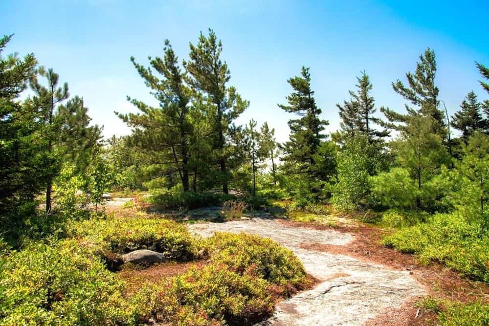

Just a hop, skip and jump away from Portland, Maine is Burnt Meadow Mountain Trail. It sits near the border with New Hampshire and is a moderate, popular, 3.6-mile loop trail with stunning views of Mount Washington (on a clear day), that is surrounded by large swaths of wildflowers.
Now, to access this trail of delight, you can use the Blue trail (aka the “North Peak Trail”) to go up the mountain. The trailhead sign will be just inside the tree line by a large grassy parking area (about 100 feet from the road).
Alternatively, you could also use the Yellow trail to go up the mountain (aka The Twin Brooks Trail”) but the blue trail is the more direct route to the top. It’s also a bit more challenging and features a variety of terrain.
So, definitely prepare for a bit of schlepping through the woods and climbing up rock faces here.
That’s why, if you’re a bit of a novice hiker like me, you may want to try to go up the mountain with the blue trail and then go back down the mountain with the yellow trail since the descent will be easier this way. Just be alert since the markers for the yellow trail aren’t always super visible.
FYI, this is also one of the best hikes in Maine that is pretty dang exposed. So, if you’re uber-pale like me, then be sure to bring a hat and some sunscreen so that you don’t get burnt to a crisp.
Also, snacks and water are, DUH, a total must to keep you fueled up and ready to go.
Pro Tip: This trail will be about an hour away from Portland as you drive towards New Hampshire. And on your way back, be sure to make a well-deserved pit stop at Lone Pine Brewing in Gorham.
Length: 3.6 miles (It will take between three and four hours to complete this hike depending on the route you use).
Difficulty: Moderate
Elevation Gain: 1,391 feet
Fee: None
2. Morse Mountain to Seawall Beach (Popham Beach State Park)

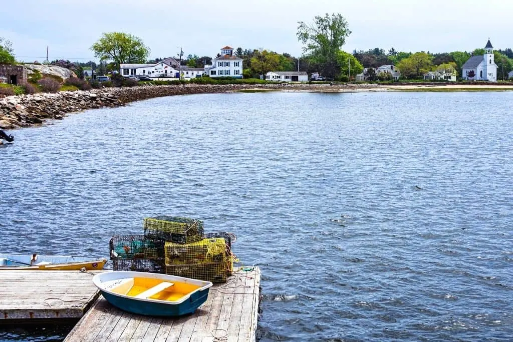
Umm…what’s not to love about this popular, out-and-back trail near Phippsburg, Maine?
I mean, not only is it easy to hike but you’ll get to take in great views of the surrounding mountains and can even end your hike with a picturesque walk on one of Maine’s best beaches.
The one downside? Parking is extremely limited so you may want to check this website for more info. Also, be careful since this hike is through a conservation area and some private lands. So yeah, definitely tread lightly and follow the rules.
Other than that though, just enjoy this sweet and easy, super scenic hike through this primo conservation area, which is filled with untouched pine forests and estuaries that eventually open up as the trail takes you to the coast.
Pro Tip: At the final fork in the trail (before you hit the beach), you’ll see signs for both Private Property and the trail. You can walk up the road to a scenic lookout where you’ll nab some super sweet views. Then just go back down the road, make a right, and head towards the beach.
Length: 4.0 miles (The entire hike should take less then 2 hours)
Difficulty: Easy
Elevation Gain: 433 feet
Fee: None
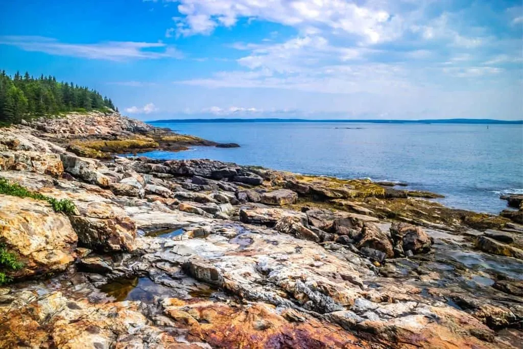
Best Hikes in Acadia National Park
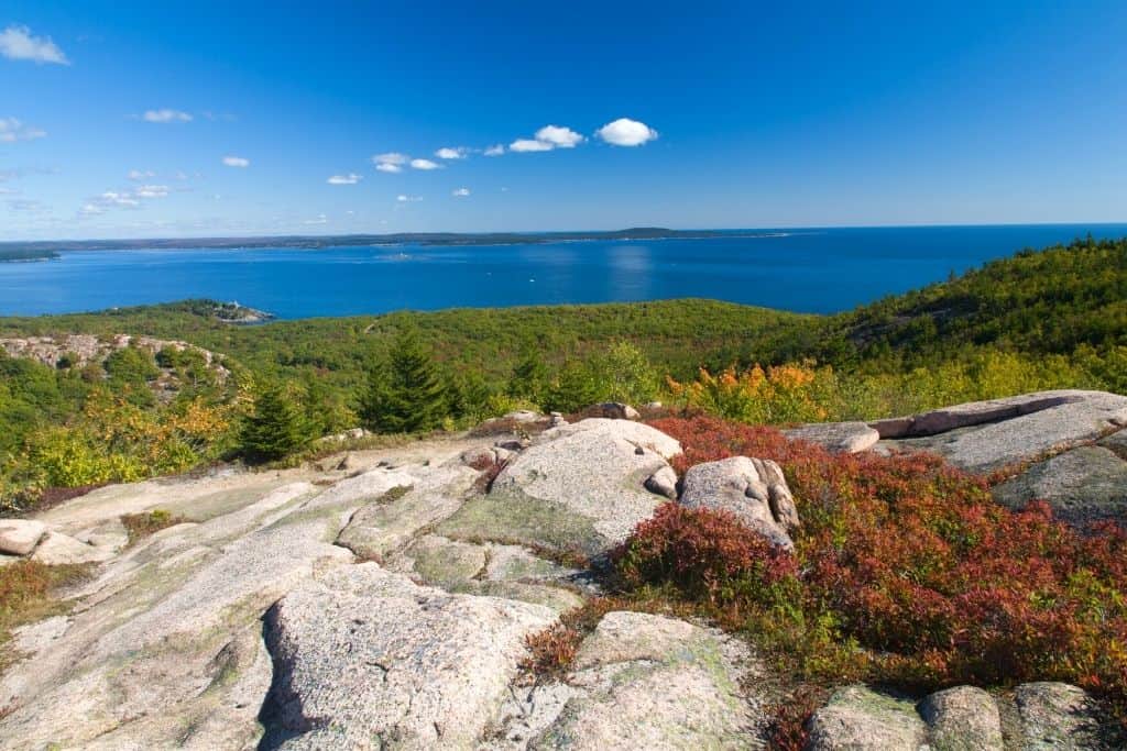
3. Cadillac Mountain

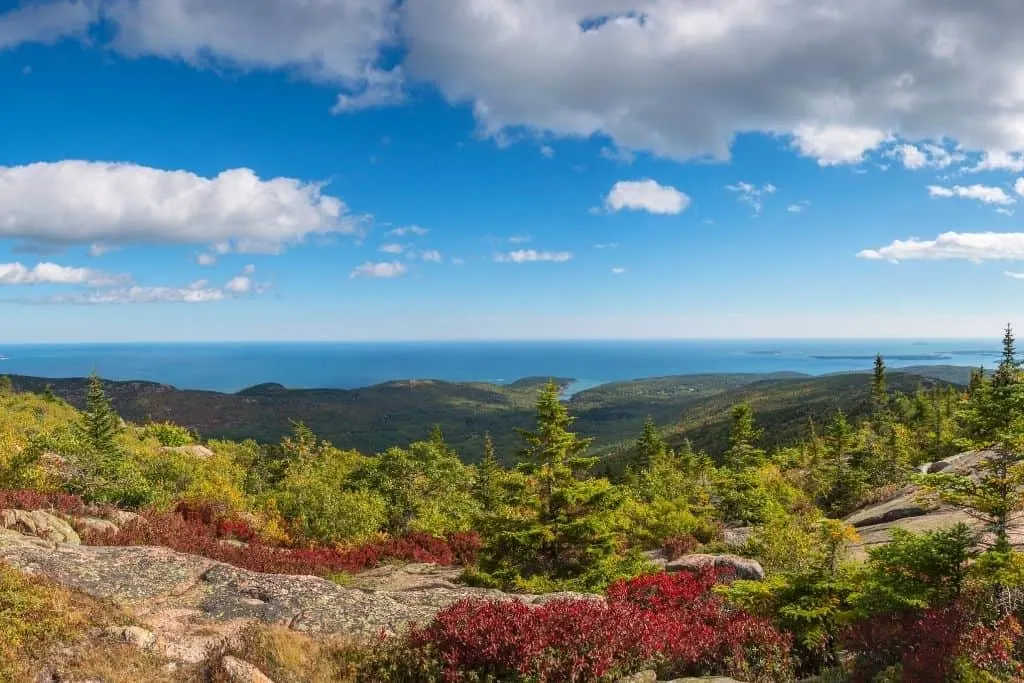
If you’re a lover of the great outdoors, then no trip to Maine would complete without a visit to Acadia National Park (the so-called “Crown Jewel of the North Atlantic Coast”) and a hike up Cadillac Mountain.
I mean, hello. Cadillac Mountain is THE tallest mountain in Acadia National Park. It’s also the most popular sunrise spot in the area since the views are stunning and this is the site of the very first sunrise in the US of A. So yeah, that’s also a super cool little factoid for ya.
However, before you get all Bear Grylls on this mountain, you’ll first need to decide which route to take to the top – the South Ridge Trail or the North Ridge Trail.
Personally, I’m lazy and hate mornings. Therefore, I’d want to take the shortest route up the mountain, which is the 4 mile, out and back, North Ridge Trail. it’s also pretty popular since it’s the quickest way to get up the mountain just in time for sunrise. Just be aware of exposed granite rock faces along the way and hike with care.
In contrast, the South Ridge Trail is a LONG 7.1-mile lopp trial up this 1,329-foot tall mountain (Talk about a daily dose of cardio with your coffee). Eventually, you’ll climb out and above the ridgeline and can savor stellar views from the iconic overlook at the Eagle Crag spur loop.
You can also rest up a bit at Featherbed Pond before making the final push to the summit.
Length: 4.0 miles (It will probably take you anywhere between two and four hours to do this hike, depending on your pace)
Difficulty: Moderate
Elevation Gain: 1,118 feet
Fee: To get into Acadia it’s $25 per vehicle or $15 per person.
4. Beehive Trail

This is one of the best hikes in Maine that could totally lull you into a false sense of security. Because while this 1.4-mile loop trail may seem short and sweet on paper, it most definitely is not.
That’s because the hike up Beehive Mountain in Acadia National Park starts off with a rock scramble pretty much right as you get on the trail, which starts right across the street from the entrance to Sand Beach.
So, climb the steps and make your way through the forest to some exposed, flat, rocky areas. Follow the light blue trail markers and use well-placed iron rungs, bridges, and handholds to make your way through the tough portions of the trail.
Because as you ascend the mountain, the trail will become almost vertical – forcing you to climb ladders and do narrow walks across a tightrope that sits on the edge of a cliff (So yeah, if you’re scared of heights this may not be the hike for you).
Yeah, definitely not for the faint of heart but worth it for the views from the top of Sand Dollar Beach.
Pro Tip: When you finally make it to the summit, you can either go down the backside of the mountain and make it a loop trail or go back the way you came and make it an out and back trail.
Length: 1.4 miles (this hike should take you about an hour and a half to complete)
Difficulty: Difficult
Elevation Gain: 488 feet
Fee: To get into Acadia it’s $25 per vehicle or $15 per person.
5. Great Head Trail

Oh, look, another one of the best hikes in Maine that is actually inside Acadia National Park.
Anyone else NOT surprised by this? Yup, me neither since Acadia is straight-up next-level gorg and filled with insanely awesome trails that you do not want to miss out on.
And the Great Head Trail is one of them since this easy hike takes you along the perimeter of the Great Head peninsula and to the eastern side of Sand Beach.
So, to enjoy this hike for yourself, get here early (like before the crack of dawn), and park in the lower Sand Beach Parking lot, which is just off the Park Loop Road.
Take the steps here to Sand Beach and follow the trail counter-clockwise from here, keeping an eye out for those nifty little blue lines.
Also, just before you begin your hike, you may want to go to the other side of the beach and enjoy sweet views of the Beehive (another epic mountain in the park).
And once you finally begin your hike, you’ll walk through white birch forests and can enjoy views of several pink granite cliffs, as well as the rocky Atlantic Coast.
You can even stop for a little picnic along the way, enjoy the amazing natural landscapes that surround you, and watch out for local sea ducks, cormorants, and gulls flying by!
Pro Tip: If you can, do this hike counter-clock-wise since there are several large stone slopes that are infinitely easier to climb up than go down. So, go to the right when you start from the steps at the top of the beach.
Length: 1.8 miles (for the full loop and it will take between 2 and 3 hours to complete)
Difficulty: Easy
Elevation Gain: 265 feet
Fee: To get into Acadia it’s $25 per vehicle or $15 per person.
6. Jordan Pond Loop Trail

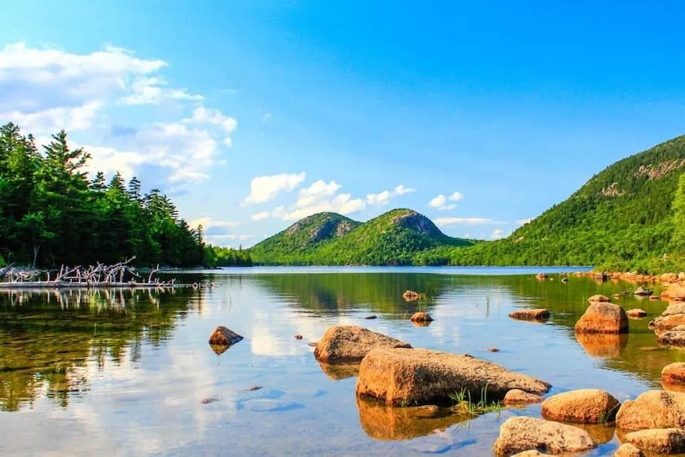
This iconic trek is easily one of the best hikes in Acadia and is without a doubt one of the best hikes in Maine too.
Therefore, don’t expect to have this place all to yourself since this easy, 3.4-mile loop trail around Jordan Pond (the deepest and second-largest lake in the park) that offers stellar views of a tranquil pond surrounded by a stunning assortment of hills.
It’s also one of the easier hikes on this list since there are a ton of unique boardwalks for you to walk along (to protect the local ecosystem) and just a few muddy patches that might give you trouble.
That being said though, there is one tiny bit of rocky terrain on this trail. Other than that, it’s just a flat, peaceful, wonderfully easy hike that everyone in your family will adore.
Heck, there are even a few sandy areas along the way where you can sit, relax by the pond, and watch for a special guest appearance from the residents of a local beaver lodge.
Pro Tip: Go early, any time between April and October, to avoid crowds and to nab a coveted parking spot since this is an incredibly popular hike. Dogs can also go on this hike but must be kept on a leash at all times.
Length: 3.4 miles (This hike will take anywhere between 1 and 2 hours)
Difficulty: Easy
Elevation Gain: 95 feet
Fee: To get into Acadia it’s $25 per vehicle or $15 per person.
Best Hikes in Mount Katahdin
7. Hamlin Peak Loop

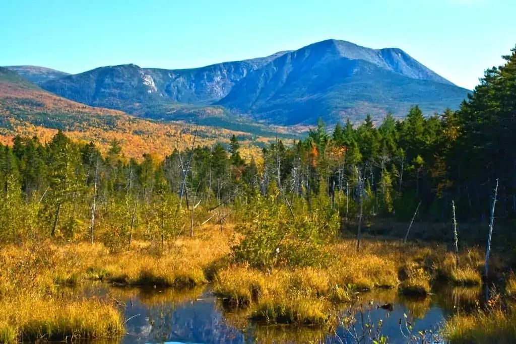
Although this is a grueling hike through Baxter State Park, this trek is 100% worth it (for sure) since you get to summit the tallest mountain in Maine.
Actually, truth be told, this hike not only brings you to the top of the tallest mountain in Maine, but it also leads you to the endpoint of the ever-famous Appalachian Trail (both are Mt. Katahdin) and brings you on an epic side trip to Chimney Pond (feel free to “oh” and “ah” at will) too.
So, if you’re ready for a challenging hike, then start off at the Roaring Brook Campground Trailhead. When you see the trail split. go to the left and head up the Helen Taylor Trail.
Continue your hike and savor the views on your way to Pamola and Chimney Peak summit Once at the top, follow the trail until you hit The Famous, an arete ridge that is sometimes only a few feet wide.
So yeah, if you’re the type of person who is afraid of heights then you may want to just head back. Otherwise, just head on up to the tallest peak in Maine and see where the Appalachian Trail officially ends.
Relax for a bit here to take in the views and then descend along an alpine plateau until you reach Hamlin Peak with its enormous cairn right on top (FYI, there’s also a great view here of Chimney Rock).
Slowlly descend along the plateau and stay left (going right will bring you to the Cathedral Trail and Chimney Pond, skipping Hamlin Peak), eventually going right and up to the tippy top of Hamlin Peak.
From here, you’ll see your incredible journey over the Pamola, the Knife Edge, Baxter, and the Tablelands before going back down the mountain, admiring the views of Hamlin at Basin Ponds before you go around the pond and finish your hike.
Pro Tip: This trail is best used between March and October.
Length: 10.9 miles (it will take about 8 hours to do this hike)
Difficulty: Hard
Elevation Gain: 4,475 feet
Fee: $12 per car to enter with an out-of-state license plate (free for Maine residents)
8. Saddle Trail
A popular way to get up to Baxter Peak is through Saddle Trail. Some consider this a challenging hike so expect to walk 10 miles roundtrip and it could take six hours or more to complete.
Chimney Pond is part of the trail and that will be a good time to take a break and get ready for the steep climb. There will also be parts where you’ll have to scramble and be on all fours. BUT this is a good trail for those that do not want to do the Knife Edge Trail.
Pro Tip: This trail is best used between April through September.
Length: 10.4 miles (it will take about 6 hours to do this hike)
Difficulty: Hard
Elevation Gain: 3,832 feet
Fee: $16 per car to enter with an out-of-state license plate (free for Maine residents)
9. Abol Trail
A direct route to the top of Mount Katahdin is via the Abol Trail. It is a 7.3-mile hike that has a vertical boulder field so you should be mentally and physically prepared for this hike!
Even though it is difficult, it is popular with experienced hikers. Switchbacks were added recently and thank goodness! Scrambling over the boulders and loose rocks was scary.
You can take a breather at Thoreau Spring and trust me you should before going up to the summit! It is one of the best hikes because the view from the top makes it all worth it with beautiful vistas above the clouds and Chimney Pond.
Pro Tip: This trail is best used between May through September.
Length: 7.3-miles (it will take about 9 hours to do this hike)
Difficulty: Hard
Elevation Gain: 3,950 feet
Fee: $16 per car to enter with an out-of-state license plate (free for Maine residents)
10. Hunt Trail
The Hunt trail is one of the numerous trails that heads up to the top of Mt. Katahdin. If you think that this is going to be a leisurely walk up a mountain then think again. The Hunt trail is a hard trail and one that should not be underestimated. It can take an experienced hiker 6-8 hours to make the round trip.
So pack your hiking shoes, make sure to pack your gear right and know your limitations when you head out to catch some stunning views on the trail.
Despite the difficulty, Hunt trail remains one of the most used trails in the area. It is also part of the Appalachian trail. The trail has everything that you could possibly desire. Waterfalls, rugged terrain, boulder scrambles, rock steps, forests and breathtaking views at every turn!
Yes! The Hunt trail is definitely worth the effort!
Pro Tip: Always check the weather or consult with a park ranger before embarking on this hike. Thunderstorms are not uncommon. It is best to try and avoid days when the forecast is rain.
Length: 10.4 miles out and back
Difficulty: Hard
Elevation Gain: 4,188 feet
Fees: $16 for non Maine residents
11. Helen Taylor
Another one of the extremely popular hikes in Maine is Helen Taylor. This trail is very exposed to the elements which has both its pros and cons. Pros being that it offers some amazing views.
The downside however means that it becomes even more challenging when the weather is bad. This is why it is recommended to avoid this trail if the weather prediction says thunderstorms. And yes! Those are common in the area.
While the trail is used by experienced hikers, it is still extremely popular and one of the most hiked trails in the area. This is because of the stunning views. It is important to note that the Knife edge part of the trail is not for people who have problems with heights! The Pamola descent down to Knife edge is probably the worst part of the trail.
Whatever you do, do not head to Knife Edge if the weather is windy and gusty.
Pro Tip: Head out on the trail early in the mornings so that you reach the top in the early hours. That will give you some of the best views. Plus, you can take your time coming back down.
Length: 7.6 miles out and back
Difficulty: Hard
Elevation Gain: 3,412 feet
Fees: $16 for non Maine residents
Easy Hikes in Maine
12. Mount Kineo
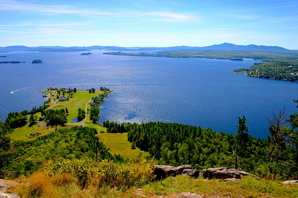
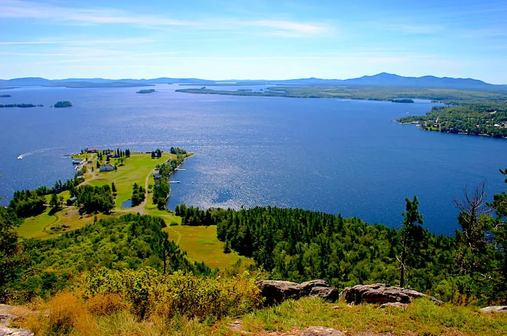
Looking for one of the best hikes in Maine that is kind of out of the way? If so then haul ass on over to Mount Kineo.
It sits inside the aptly named Mount Kineo National Park and is located just near Greenville, along the shores of Moosehead Lake.
So yeah, this park is pretty removed with a capital “R”. Anyway, to make this a really fun day out, I’d hop on the local ferry from Rockwood boat launch and take that all the way across the lake to trail at Mount Kineo (the ride is $13).
Seriously, it’s just a super fun way to see the lake. It’s also pretty dang bumpy so be sure to hold on.
Once there, expect a fairly easy climb to the summit. I mean, I had no trouble with the hike. And trust me when I tell you that I am far from a mountaineering guru/fitness expert.
You just need to choose between one of two trails to the summit – the longer but easier Bridle Trail or the more challenging Indian Head Trail along several local cliffs.
I’m a wimp and opted for the easier of the two but I’ve heard both are well marked and completely accessible. So yeah, you could take grandma on this hike and she would be totally fine.
Especially since the Birdie Trail was once an old fire warden trail. It also starts with a 0.3-mile walk along the Carriage Trail that eventually takes you through several large groves of maple and birch trees before joining up with the Indian Trail right before the summit.
And once at the top? Well, be sure to hold on for dear life (kidding, it’s not THAT bad) as you make your way to the top of an old fire tower for the best views ever – a structure that was actually converted into a handy dandy viewing platform almost two decades ago.
Length: 3.4 miles
Difficulty: Moderate/Easy (Birdie Trail is easy and Indian Head Trail is more moderate)
Elevation Gain: 905 feet
Fee: $3.00 for Maine residents and $4.00 for non-Maine residents.
13. Shoreline Trail
If you plan on going to Lily Bay State Park, you can do an easy hike while spending the day at Moosehead Lake. Shoreline Trail is a quick 30-minute hike, OK, it’s more of a walk! But it is something fun to do other than boating, swimming, or fishing.
The trail is along the lakeshore so there are plenty of chances to see water birds and other wildlife. It is a well-marked trail with most of the forest floor smoothed out.
You can get a map of the trail and follow the main path or go off on side trails that lead to swimming spots and viewpoints. Otherwise, follow the trail up to Dunn Point just watch out because the path isn’t as clear with rocky areas and roots.
For those of you who have a Maine State Parks Passport, make sure to get a stamp at the park’s passport station.
Length: 1.7 miles
Difficulty: Easy
Elevation Gain: 65 feet
Fee: $4.00 for Maine residents and $6.00 for non-Maine residents.
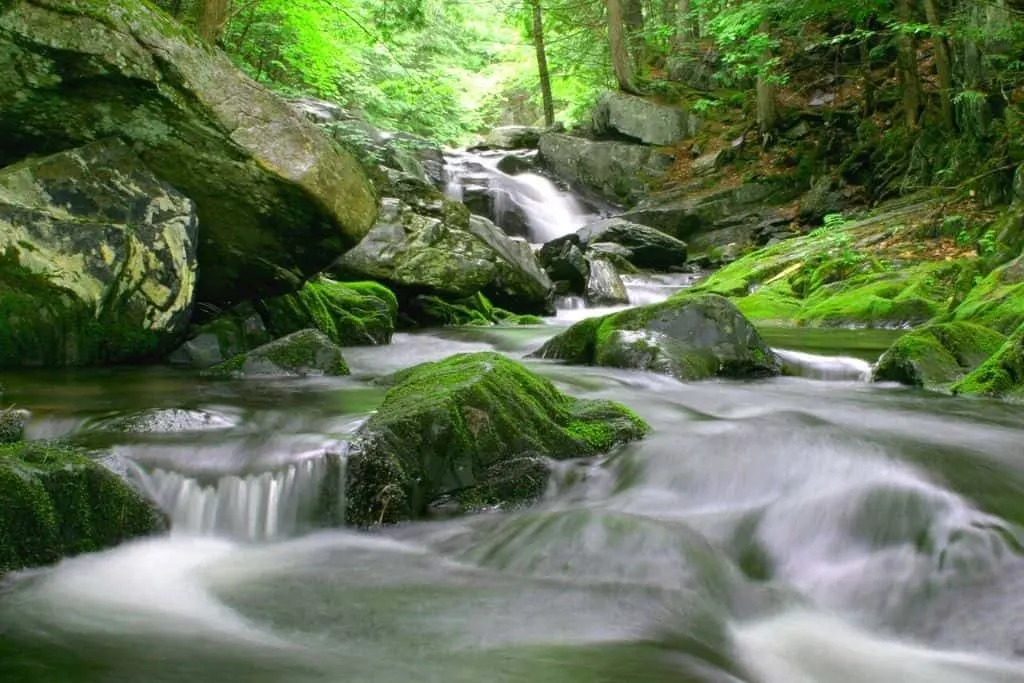
14. Moxie Falls Trails

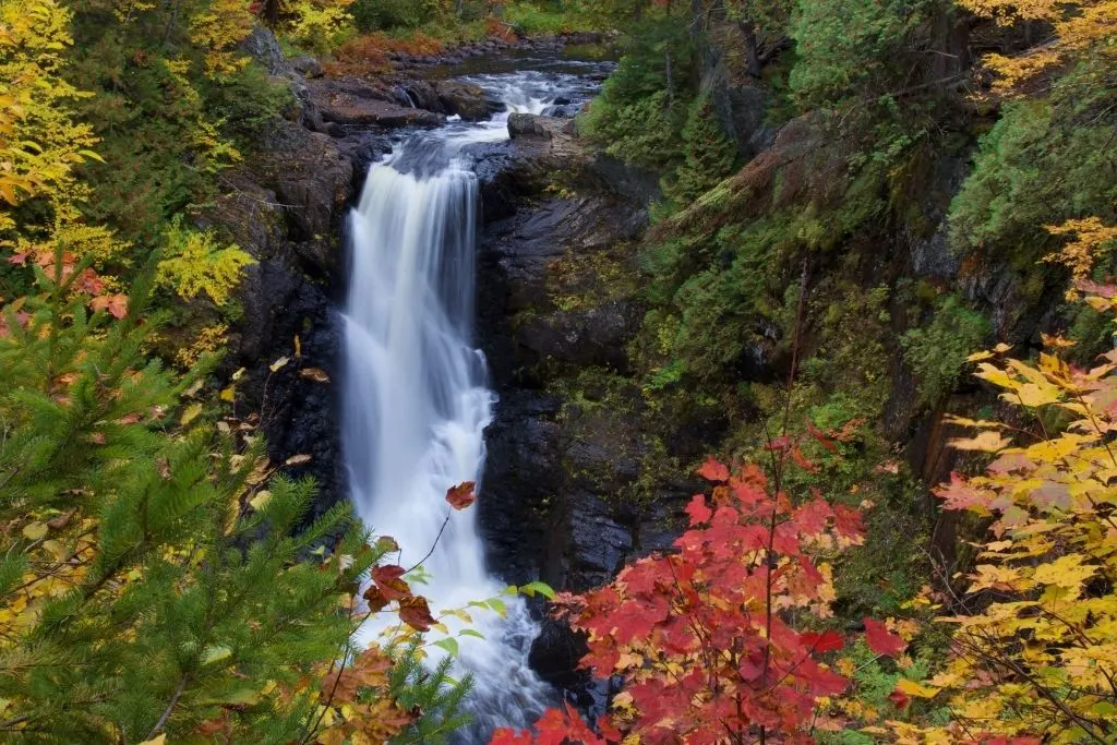
For one of the best hikes in Maine with great views, I highly recommend Moxie Falls.
It is also one of the easiest hikes to take because the path is well-marked and the walk up is pleasant because of wooden steps and platforms that make the experience safe for visitors.
It takes about an hour to do the loop if you don’t stop. But Moxie Falls is beautiful and it is super easy to stop and take pictures because of the viewpoints with wooden platforms.
Moxie Falls is one of the highest waterfalls in Maine that plunges 90 feet down into Moxie Stream.
It is a super popular trail so it is best to get there early to snag a parking spot and enjoy the walk. You can also swim in pools below and above the falls but be ready for chilly water!
Length: 2.10 miles
Difficulty: Easy
Elevation Gain: 232 feet
Fee: Free
Some of the Other Easy Hikes in Maine
15. Table Rock
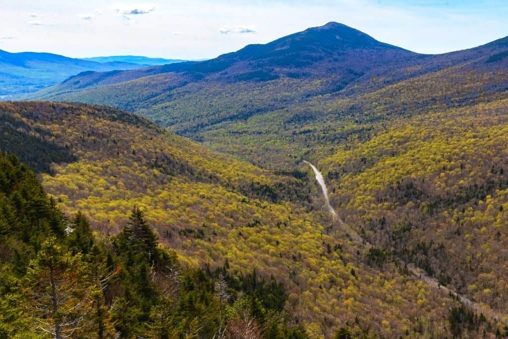
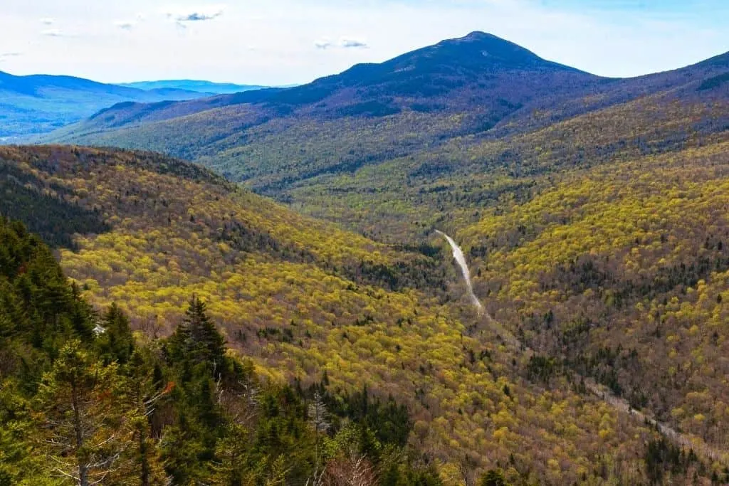
Located in Grafton Notch State Park, this glorious hike up Bald Pate Mountain will take you up to a glorious viewpoint (just not the summit) where you can enjoy some of the best views along the Appalachian Trail.
So, to set out on this most excellent of hikes, you’ll first need to park in a parking lot off Route 26 near Newry, Maine.
You’ll then have to walk across Route 26 (it can be busy so watch out for oncoming traffic) to access the Appalacian trail and start your hike up Table Rock.
Right away, you’ll discover an intersection and can either go left to Baldpate (this is the easier trail) or go right and ascend a more difficult trail with tons of boulders.
Personally, though, I’d go left and do a gentle climb up the mountain and across wooden planks that cover slightly muddier sections of the park.
Pretty soon, you’ll find a sign that says “Table Rock” and you’ll just follow that to the top. Just be aware that the hike can get pretty steep and that you probably will need to climb up metal rungs along a near-vertical rock face (this is on the blue trail).
But, after a bit of quick scrambling, you’ll finally make it to the top and can enjoy the stellar panoramas all around you.
Pro Tip: If you’re looking for an easier hike, try taking the blue/white trail up the mountain and then back down. Otherwise, you can do the loop and try taking the orange trail up (very steep) and then the blue/white trail back down. And if you want to make your hike a bit longer, you can always add on a trek to Baldpates since the trail shares a trailhead with Old Speck.
Length: 2.7 miles (This hike will probably take between 2 and 3 hours)
Difficulty: Hard/Moderate
Elevation Gain: 869 feet
Fee: $3.00 for Maine residents and $4.00 for non-Maine residents.
16. Mount Battie


Heading to Camden? If so then you cannot leave this beautiful beach town without first doing one of the best hikes in Maine!
Because the out and back trail up Mount Battie is pretty darn immortal (read, super popular, and crowded) and offers sick views of Penobscot Bay and downtown Camden.
So, if you want to take on all this cardio-erific glory for yourself, then drive up to Mountain Street (from downtown Camden) and take a left on Spring Street, closely followed by another left on Megunticook Street.
Once here, you’ll find a small parking lot at the end of the road that you can use to park your car and access the trailhead.
Now, when you finally do start your hike, it’ll be a steep climb up the south-facing side of the mountain. Therefore, definitely expect to do a bit of scrambling up rocky section of the trail.
When you finally make it to the top though, you can climb up a stone tower there and enjoy even better views of Camden down below.
Pro Tip: If you’re not up for this insanely steep hike, you can always drive to the top of Mount Battie instead. This hike is also VERY popular and is best done early on a weekend day morning, between May and October.
Length: 1.1 miles (This hike will probably take about 2 hours)
Difficulty: Moderate
Elevation Gain: 590 feet
Fee: $4.00 for Maine residents and $6.00 for non-Maine residents.
17. Gulf Hagas Rim Trail and Pleasant River Tote

Want to see an uber-famous Maine landmark that is often fondly referred to as the “Grand Canyon of Maine”?
If so then the Gulf Hagas Rim Trail is just the spot for you. Because it’s not only one of the best hikes in Maine, but it’s also one of the most scenic since it takes you along Gulf Hagas – an ancient gorge that was first carved out by the ferocity of the Pleasant River and that is brimming over with stunning waterfalls.
So, over the course of nine-miles (there are shorter trails too if that’s a bit too long for you), you’ll descend 500 feet and make your way across uneven terrain that is littered with rocks and tree roots. Therefore, be sure to wear a solid pair of hiking shoes for this trek.
However, to truly get the most out of your hike, be sure to park at the Head of the Gulf Parking Area (use the other lot and you’ll have to walk through a river that is knee-deep) and then walk across a bridge to join up with the Appalachian Trail.
Continue for another 1.3 miles away from the river and follow the blue-blazed Rim Trail past a bunch of waterfalls and to various lookout points along the perimeter of the gorge.
You can then rock hop it across the Gulf Hagas Brook and take a short walk to Screw Auger Falls. It’s about 3.5 miles to this point so you can either continue around the entire Gulf or head back from here.
Pro-Tip: The area is pretty remote and has a ton of uneven terrain. Therefore, be sure to wear sturdy hiking shoes. You’ll also want to consider using a walking stick, and bringing a compass/map since you probably won’t get cell service here.
Length: 8.2 miles
Difficulty: Moderate
Elevation Gain: 905 feet
Fee: $10.00 for Maine residents and $15.00 for non-Maine residents.
18. Tumbledown Mountain

Looking for an awesome hike in western Maine? Then try Tumbledown Mountain.
Sure, it’s not the tallest peak in the state, but it’s definitely a whole hell of a lot of fun since this peak rises about 3,000 feet in the air and is home to a ton of different trails that are just waiting to be explored.
There are also several 700+ foot sheer cliffs that sit along the northern side of Byron Notch that are pretty neat to see, as well as Tumbledown Pond which sits at about 2, 800 feet in the air and is surrounded by picturesque mountains on three different sides.
Now, to summit the mountain, there are a couple of different routes that you could take. Personally, I’d start out on the Brook Trail since it’s the easiest and most direct route to the pond.
You’ll know you’re almost at the pond when the trail becomes a bit steeper at about 1 mile in. The path will then continue to follow a little brook that will eventually lead you to the pond.
Once at the pond, you can access the Loop Trail and take it up the mountain. It’s steep but fun and requires that you pay close attention since the upper portion of the trail can be difficult to follow.
If you choose to ascend via the Loop Trail, you’ll go over the Great Ledges and can take in epic views of the Tumbledown Cliffs from here. You’ll then climb a ridge in the gully before you and the trek will get VERY steep.
As you near the top, huge boulders will block your way as you climb up through a gap to the left and use metal rungs attached to a rock here. You’ll then come up and out of this steep climb and hit Tumbledown Ridge Trail.
You’ll then use this trail to climb up to the summit on the West Peak and complete your loop hike as you go back down via the Brook Trail.
Pro-Tip: The local parking areas here are located about a tenth of a mile AFTER the trailhead. And once you park, you may miss the sign for the trailhead since it’s a solid 30 feet into the woods. So, just keep your eyes peeled and just know you’re in the right place.
Length: 5.3 miles (this hike will probably take around five hours total)
Difficulty: Hard
Elevation Gain: 1,952 feet
Fee: free
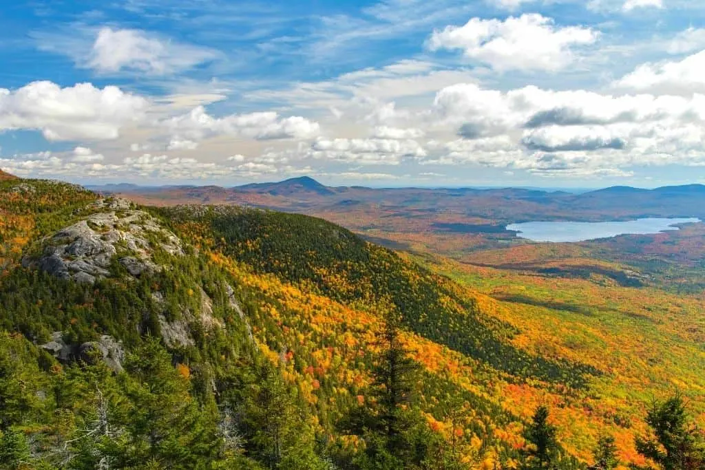
19. Mount Bigelow

If you want to conquer even more of the Appalachian Trail, then check out Mount Bigelow! It stands at an impressive 4,090 feet and is part of the 10,000 acres Bigelow Preserve near Stratton, Maine.
It’s also easily one of the best hikes in Maine since you can admire impressive views of Flagstaff Lake from the top and can actually hit three different peaks (The Horns, West Peak, and Avery Peak) using a single, 12+ mile loop trail.
So, to start this epic hike, park your car at the Stratton Brook parking area just off Stratton Brook Pond Road.
Next, follow the dirt road for about a half-mile, until you hit the Stratton Brook campsite. Take the Fire Warden’s Trail from here, staying left at a junction with the Horns Pond Trail, and hiking onwards for about 4.5 miles.
When you hit the Avery Col Campsite, head right onto the Appalachian Trail and hike for another half-mile until you reach the Avery Peak summit.
After enjoying the views, double back to the Avery Col Campsite junction and go left on the Appalachian Trail, until you hit the West Peak.
Now, depending on how tired you are, you could either go back to the parking lot the same way you came, or continue to the South Horn.
To continue your hike, trek through Bigelow West Peak on the Appalachian Trail for about 1.8 miles, until you reach the summit of South Horn. Keep going straight until you come to a junction with Horns Pond Trail (you’ll see a shelter here).
Make a left onto Horns Pond Trail and hike for a solid 2.5 miles until you reach an intersection with the Fire Warden’s Trail. Take this trail back to the Stratton Brook campsite and walk on the dirt road until you get back to your car.
And tada! You have just hiked Mount Bigelow. Insert uber-excited jazz hands here. Just know that although this hike may sound easy, it’s intense and consists of a full day of hiking.
So moral of the story? Know what you’re getting into and always be prepared.
Pro-Tip: This hike definitely offers some of the best views in Maine and you should try to go any time between May and November (earlier is better since by November the trail could have ice/snow).
Length: 12.2 miles (This hike should take somewhere between 7 and 8 hours to complete)
Difficulty: Hard
Elevation Gain: 3,825 feet
Fee: Free
Hikes In Maine FAQ
Does Maine Have Good Hiking?
Maine has some epic hikes and it is one of the top reasons why people visit this gorgeous state every year. The famous Acadia National park is one of the places that draws hikers. There are numerous hiking paths within the park itself.
The eastern coast has one of the longest walks ever. Yes. I’m talking about the Appalachian trail. So you see, not only does Maine have amazing trails, it also has some of the best places to hike in the country!
What Is The Hardest Hike In Maine?
The Precipice trail in Acadia National park is known as one of the hardest hikes in Maine. The name itself probably gives the difficulty away. Not only do you zigzag up the peaks of Champion mountains, you also ascend over 1000 feet in less than a mile. So yes! It is pretty steep and dangerous.
It is a trail that is recommended only for experienced and advanced hikers. Make sure you are prepared if you head out on this one.
What Is The Most Hiked Mountain In Maine?
Not an easy question to answer but Mt Katahdin is the most hiked mountain in Maine. It is a part of the Appalachian trail and is 5269 feet tall. The height does not seem to deter hikers. Mind you, the trail isn’t easy either. It takes anywhere between 8-12 hours to hike and the going is pretty strenuous.
A Map of the Best Hikes in Maine
Other Maine/USA Travel Resources You Will Love
- The Absolute Best Time to Visit Maine
- 15 Stunning Beach Towns in Maine You Must Visit
- 15 Amazing Romantic Getaways in Maine
- 10 of the Most Awe-Inspiring Scenic Drives in Maine
- Best Hikes in Acadia National Park
- 7 of the Best lighthouses in Portland Maine
- 17+ Amazing Things to do in Rockland Maine
- 15+ Awe-inspiring things to do in Portland Maine
- 15 Best Things to do in Kennebunkport Maine
- 16 of the Cutest and Best Towns in Alaska
And there you have it, you avid lover of the great outdoors you!
Because that just about wraps up this hella epic post on all of the best hikes in Maine!
Now use this guide well and feel free to make any and all your greatest Bear Grylls-inspired dreams come true!
And if you found this post helpful, then pin it now so that you can read it again later!


Katy
Saturday 13th of March 2021
I've actually never been to Maine before bit it's high on my bucket list. I'm looking forward to checking out some of these awesome hikes when I do!
Natalie
Saturday 13th of March 2021
I never thought of choosing Maine as a hiking destination, but you may have convinced me! These all look beautiful!
Lina
Saturday 13th of March 2021
These are some really wonderful hikes you featured in this post! I bet it can be hard to choose which one to take because all of them lead through the most stunning landscape it seems :)
Stefanie
Saturday 13th of March 2021
Looks like there is a lot to do in Maine! :) Love the details you provide! Greetings from the West Coast!
lisa
Saturday 13th of March 2021
love all the detail you provided in this post! super helfpul to compare the hikes side by side to pick the one thats right for me!!